July 7, 2007
Last updated: 7/13/07 10:00pm PT
Forks, Hoh Rain Forest, Ruby Beach, Quillayute Needles, WA 2007
The local tour continues. It was back to the west coast to the Hoh Rain Forest, one of three temperate rain forests in the world (southern Chile, & New Zealand have the others). We had some extra time, so we also hit two more Pacific Ocean beaches, Ruby Beach and Second Beach. We spent the night in Forks to get a head start on the hiking in the morning. This turned out to be a good idea. When we arrived at the Hoh Rain Forest, we were the third car in the parking lot. When we left, the lot was full. We chose Forks because this 10 block town is the only thing in this corner of the world that mildly represents civilization. We stayed at the Dew Drop Inn, which had large rooms and a not too awful bed.
The main focus of this trip was to see the Hoh Rain Forest, one of the wettest places on Earth. 12 to 14 FEET of rain falls here in a year. This past winter there were a couple of big storms that blew down trees and the heavy rains washed out roads. One poor guy got his rental car stuck on the wrong side of a washed out bridge. The car was stuck until spring. The rental car company wasn’t very understanding.
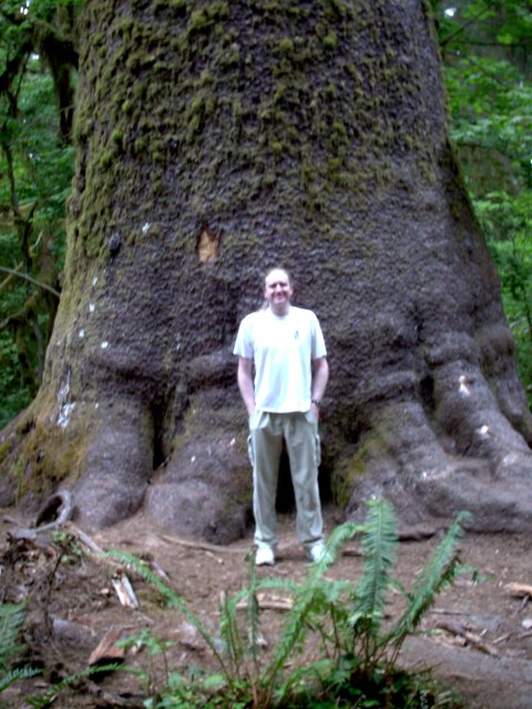
On the road in to the Hoh Rain Forest, there is a very large tree. This is a Sitka Spruce, about 270 feet tall, 12.5 feet in diameter and about 500-550 years old. 
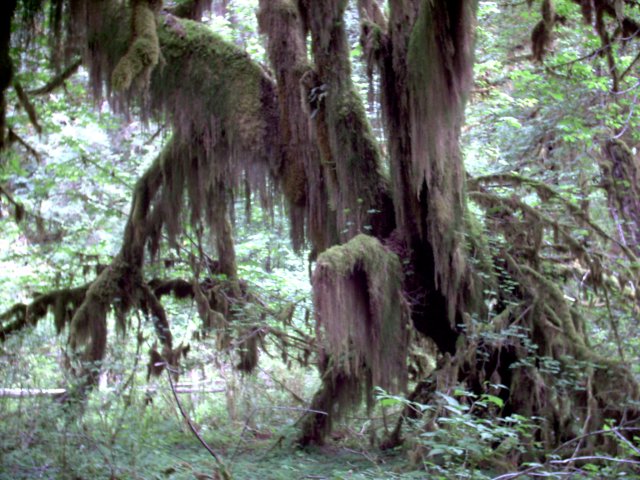
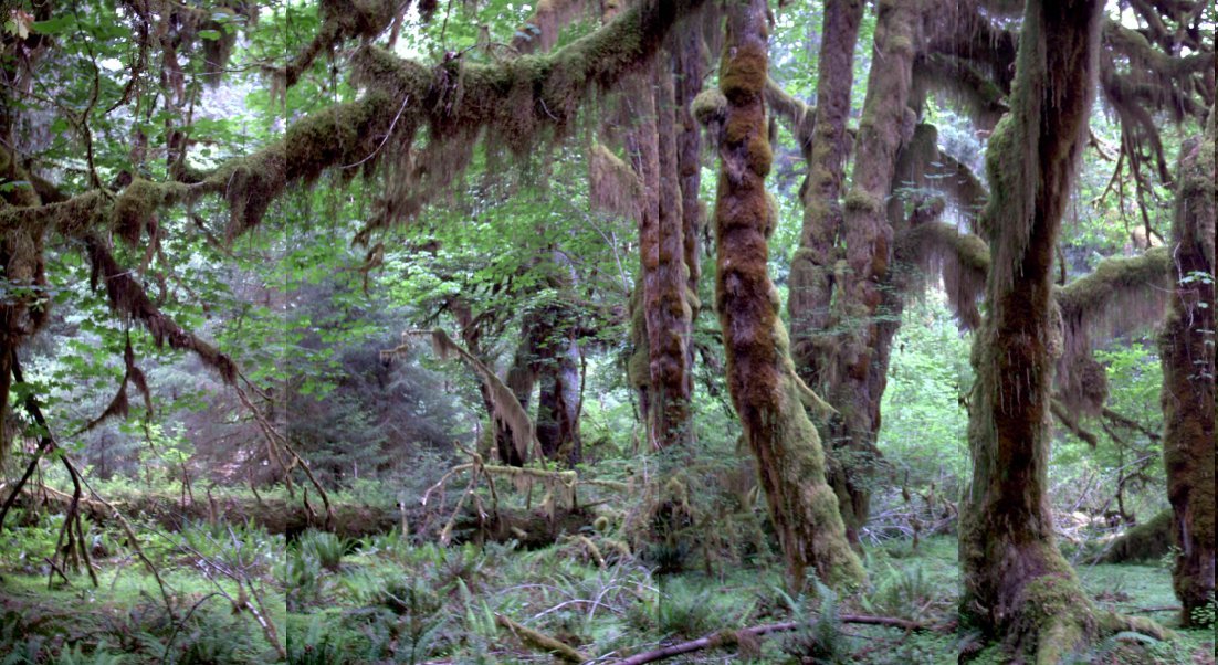
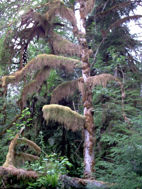
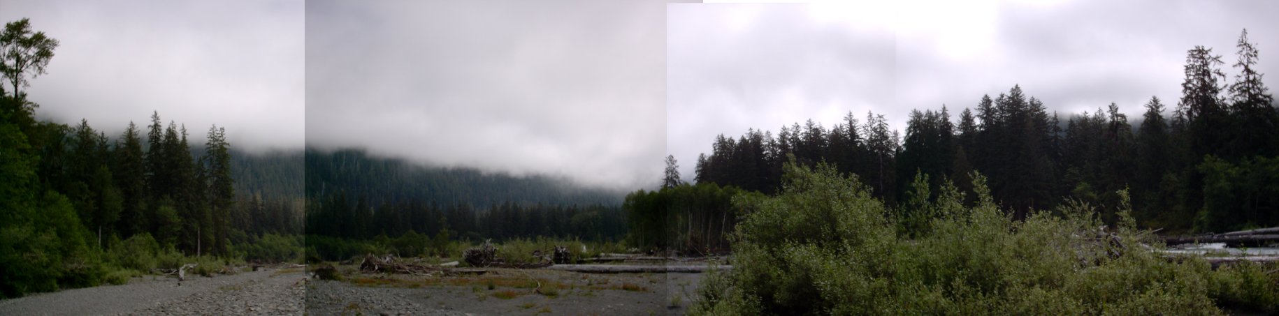
 The main claim to fame in the Hoh Rain Forest is the moss that grows on the trees. The moss gets all its nutrients from the air. Moss isn’t a parasite on the trees. The first hike was in the Hall of Mosses, a 3/4 mile trail. The wide picture below looks like a painting, but I swear it’s real (other than being pasted together from four pictures). Go ahead, click on it, you’ll think you’re seeing dinosaurs hiding behind the trees.
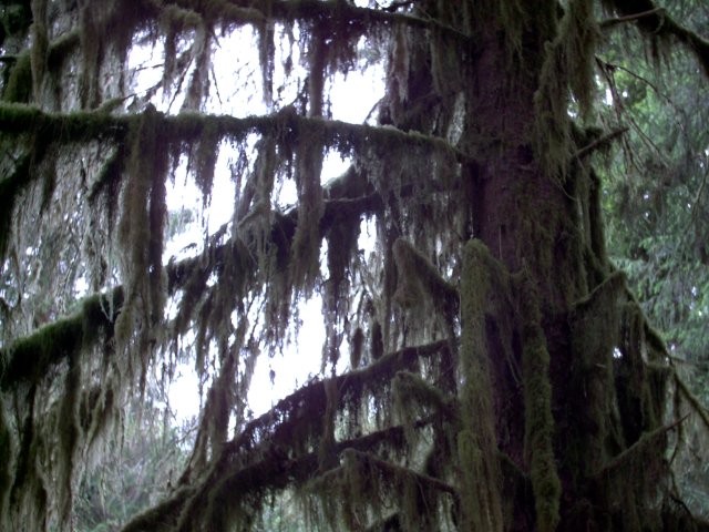
 Next was the Spruce Nature Trail at 1¼ miles. I had mentioned the big storms last winter. Here is some evidence. Denise is counting the rings and estimated about 300 years old. The tree fell over the path and a small section of the tree was removed to restore the path. Denise is standing in the depression left in the trail when the tree fell. Must have been a loud boom! Of course, if no one was there to hear it, did it make a sound?
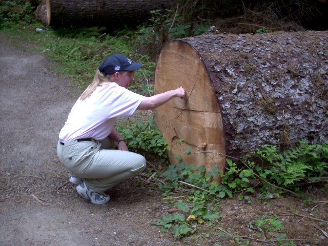
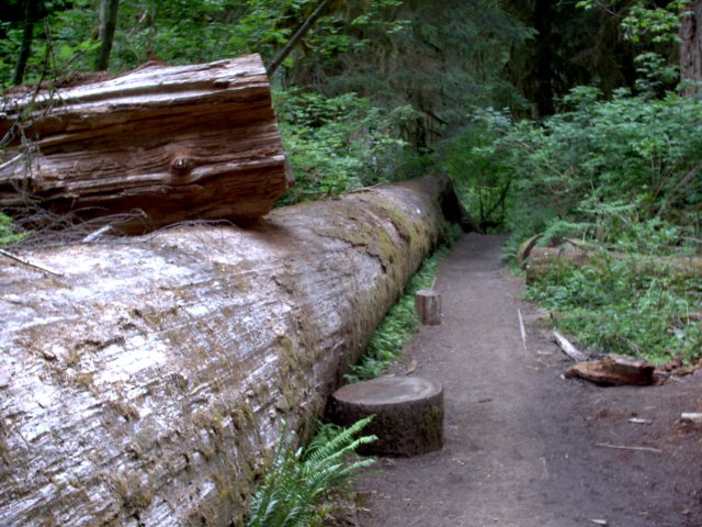
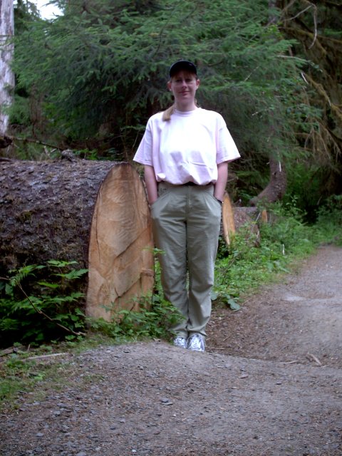 Here I am standing next to a tree trunk that is 190 feet long. The tree, when standing upright, was taller but broke when it fell. (These trees average 220 feet and can grow to over 300). This one landed on a hill and bent in the middle. Denise is taking the picture from just past the bend. If she was at the top of the tree, you wouldn’t see me. The second picture is from where I was standing in the first picture.
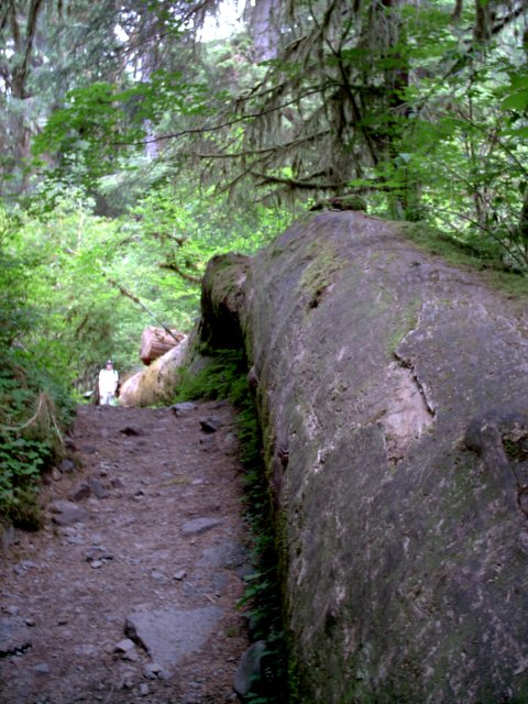
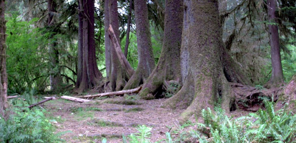
 In the forest, when a tree falls, it becomes a nurse log. Plants and other trees use the decaying tree for nutrients to help them start growing. Over time the nurse log is all used up and disappears. In the pictures below, you can see the roots that used to grow through the nurse log, and are now exposed. In the 3rd picture, you can see all the trees lined up in a row, where the nurse log was. These trees are at least 100 years old and probably closer to 200 years.

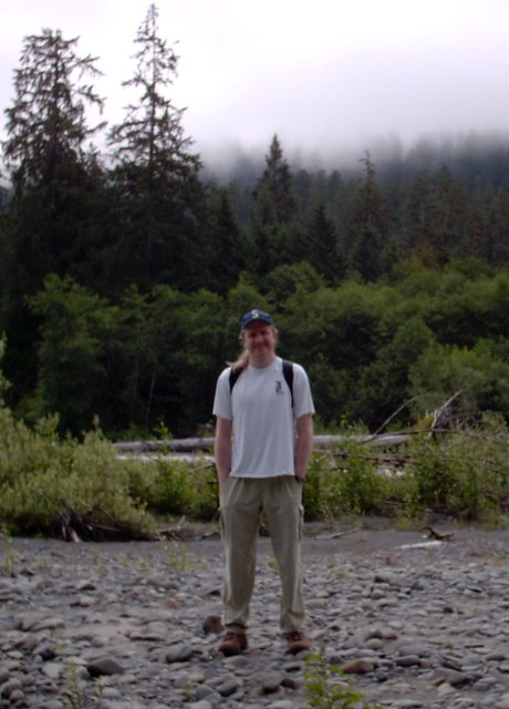
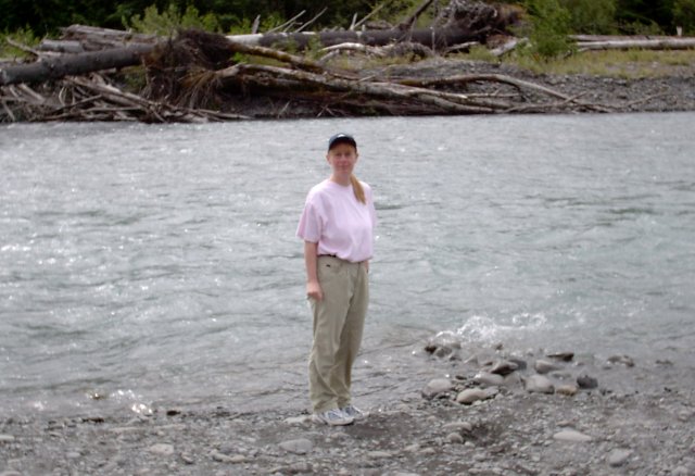
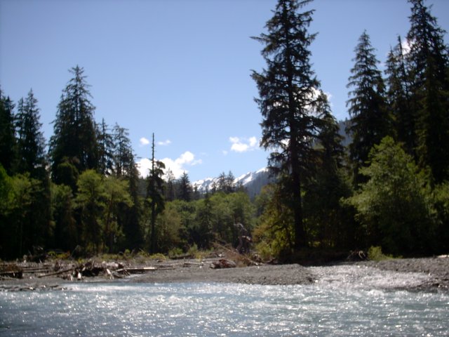
 Part of the Spruce Nature Trail runs along the Hoh River. It was very foggy in the morning. And of course, in July, the river isn’t as wide as it is in the spring.
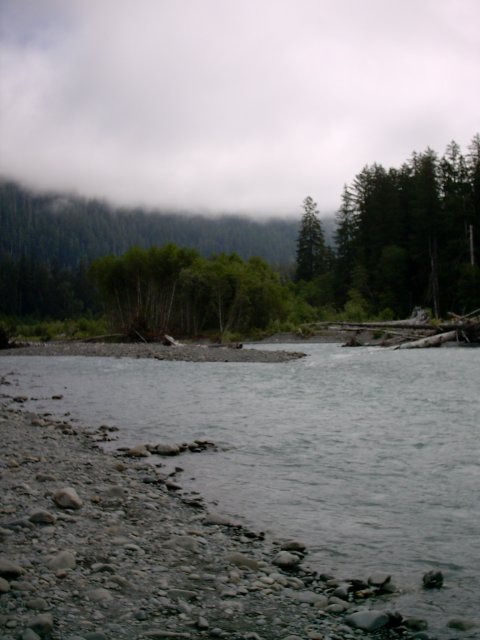
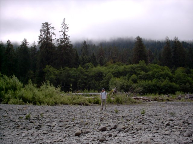
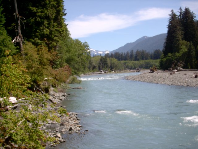
 After a quick lunch, we headed out on the Hoh River Trail. I like to see stuff when I hike, so we read in the guide books that there was a waterfall about 2.5 miles from the start of the trail. At this point in the day, the sky began to clear. You can see snow on the mountains in the distance.
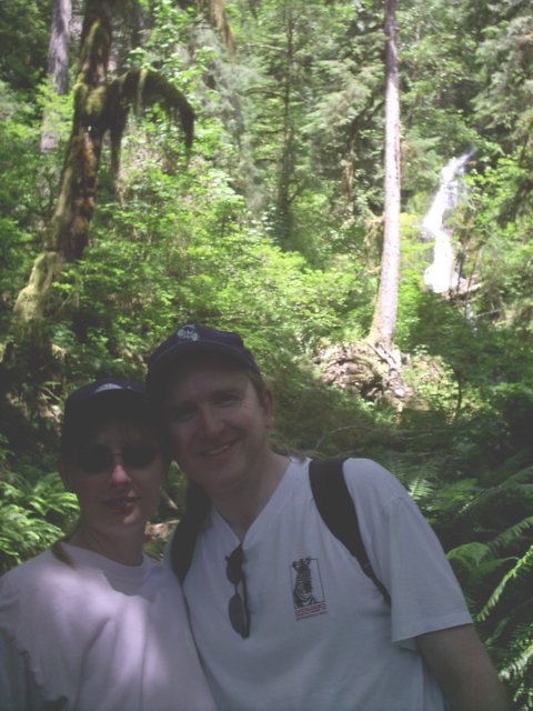
 The waterfall is not worth the 5 mile round trip hike. Another hiker was passing by, so we took pictures of each other. I had to tweak the picture of us. It was so sunny in the background and my flash didn’t go off.
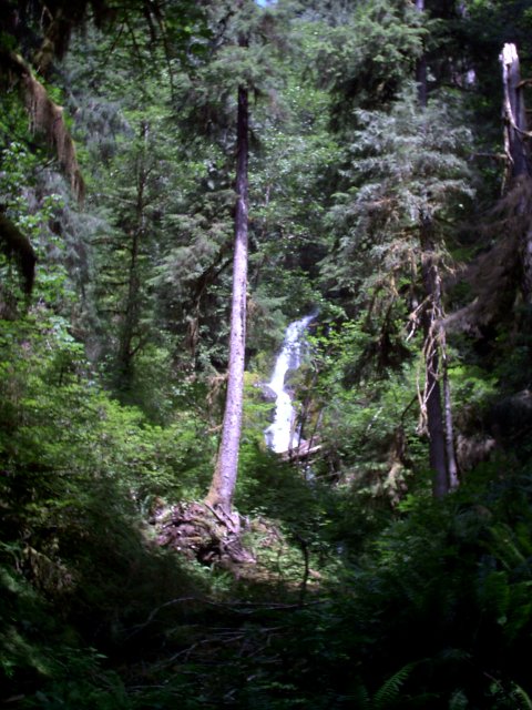
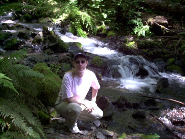
 The waterfall then becomes what I would call a rapidly falling stream.
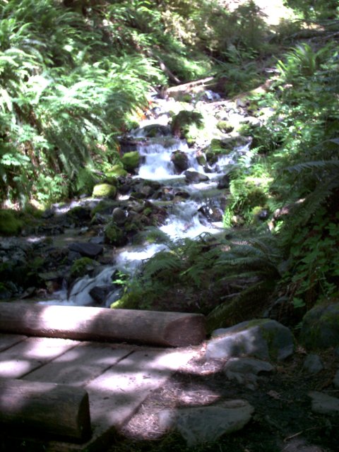
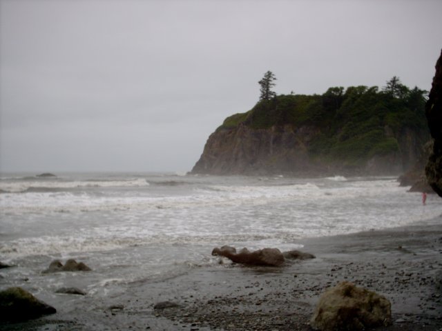
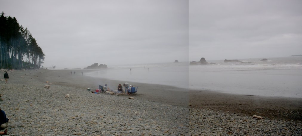
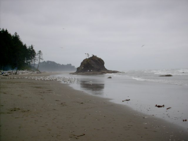
 Not far away, was Ruby beach on the Pacific. The sand is supposed to be pinkish due to the grains of garnet mixed into the sand. I’d have to disagree with that. I took a close look and saw no pink or red; nothing but gray. There are some sea stacks here, but not as many as Second Beach. You may notice in the first picture that we are much higher than the beach. There are some serious hills to traverse to get to the beaches here. This one wasn’t too bad. Second beach is brutal (at least on the climb back up).
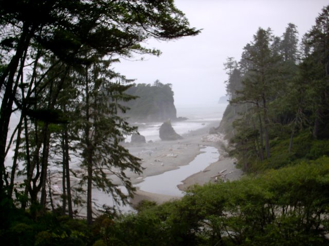
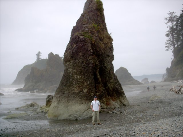
 Natural sea stack or monument to the aliens? Maybe a monument to Daniel Boone?
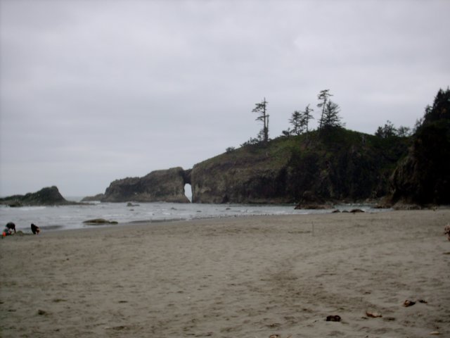
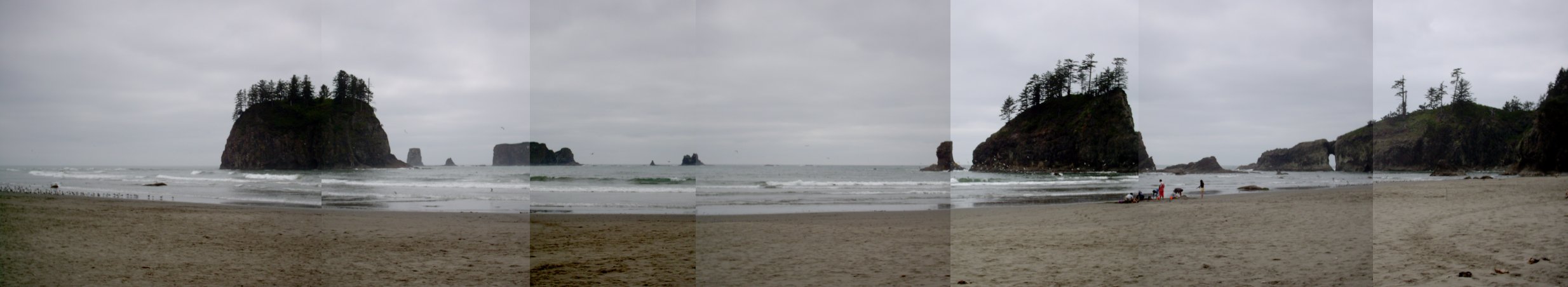
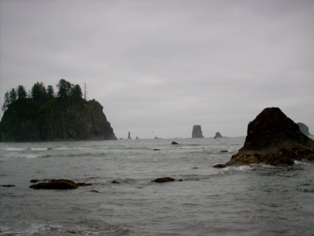
 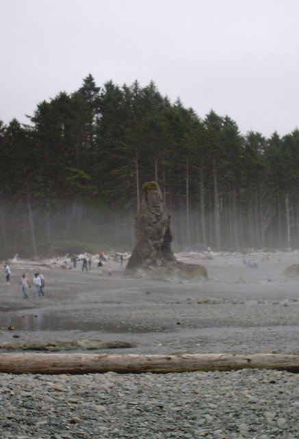 The last stop was another Pacific beach just north and west of Forks. We stopped to see the Qullayute Needles. These are just off Second Beach. Second Beach being conveniently found between First Beach and Third Beach, of course. The pillar shaped sea stacks are called needles. They are formed by the erosion of land. At one time the end of the land was hundreds of feet (maybe even thousands of feet) further west. The water erodes the land unevenly, causing some pieces of land to become the pillars and sea stacks.
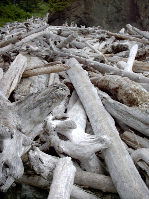
 Getting off the beach was a challenge. Actually getting on the beach was the same challenge. You can see below the large pile of driftwood (I’m hesitant to call it driftwood, but rather drift-giant-trees). That’s Denise in the first picture, on top of the pile. The second picture is from the top of the pile. You have to climb over this mess to get to and from the trail that leads to the beach. Once past the trees, we had to hike up at least 300 feet or more in elevation to get to the car.
 Got a late start for home because we actually wanted to eat dinner in Forks, if you can believe it. There’s a place called Chicago Ru’s that has Italian Beef sandwiches. So far, every time I find one of these places owned by former Chicagoans, I’m truly disappointed. No exception this time. The beef was sliced thin, which was good, but the juice lacked much in the way of Italian spices. And the bread was just a large hot dog bun, totally wrong. We chatted a bit with Ru, the owner. He’s from the south side, and took a round-a-bout way thru life to the coast. Seems like a nice guy and hopefully the folks in Forks won’t know what they’re missing.
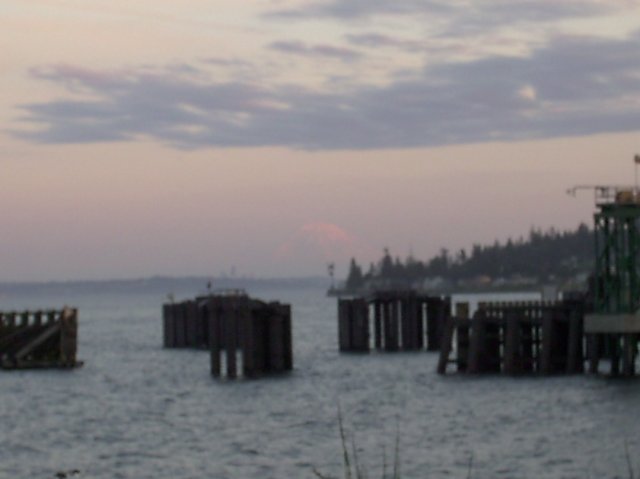
Here is the ferry coming to get us for the ride home across Puget Sound. The second picture is hard to see, I wish we had gotten there a few minutes earlier to get a better shot of the sunset reflecting off Mt. Rainier. 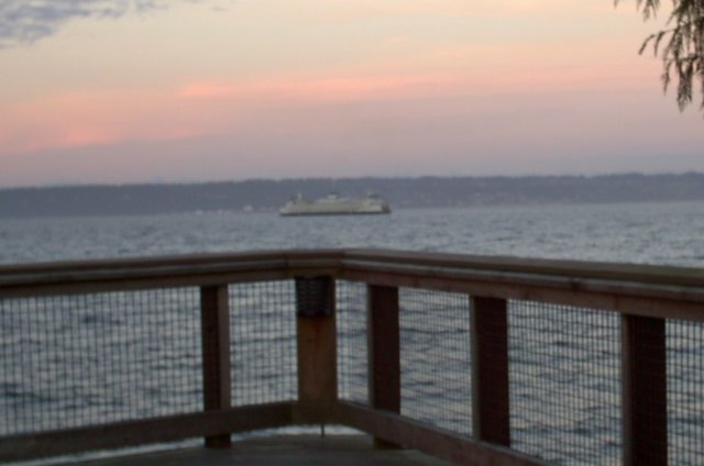
 Commentary: I didn’t take any pictures of the clear-cut forests; we passed quite a few on our drive west. The Washington State Trust Lands are apparently up for cutting by the highest bidder. (At least I hope they are getting the highest bidder and not the governor’s cousin). The money is supposed to go to the schools. It’s depressing to look at the large sections of forest that are “managed with care” according to the signs. The weathered gray tree stumps go up the sides of mountains like gravestones climbing to heaven. Hardly enjoyable to look at. Don’t get me wrong, I like toilet paper as much as the next guy. I know my wood and paper has to come from somewhere. But why can’t it be Iowa? 🙂